


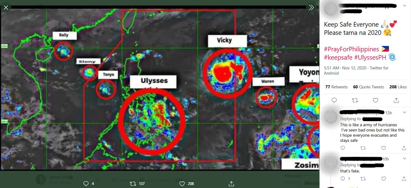
(Updated 3:06 p.m.) A science organization labeled a viral Facebook post claiming that another tropical cyclone would immediately arrive after “Ulysses” as “misleading” and said that there are no projected low-pressure areas in the Pacific in the next seven days.
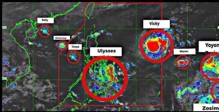
Earth Shaker Philippines warned the public that a graphic labeling the supposed formations of upcoming tropical cyclones “Vicky,” “Warren,” “Yoyong” and “Zosimo” in the Pacific Ocean is “fake news.”
“Wala pong kasunod agad na bagyo o LPA ang Typhoon #UlyssesPH. Huwag po tayong magpakalat ng mga ganitong balita upang hindi makadagdag sa alalahanin ng mga tao. Bukod sa epekto ng bagyo, mag-ingat rin po tayo sa mga fake news!” the group said on a Facebook post Thursday.
It shared the graphic that has been going around in the local online community which encircled the supposed formation of low-pressure areas and said in an inline text of their post:
“WALANG Low Pressure Area (LPA) o Tropical Cyclone na kasunod agad ng Typhoon ‘ULYSSES’ ang binabantayan ngayon sa loob o malapit sa Philippine Area of Responsibility (PAR). Wala ring pinapakita ang parehong ECMWF at GFS model na posibleng bagyo sa susunod na 7 araw,” the group said.
ECMWF refers to the European Centre for Medium-Range Weather Forecasts while GFS refers to the Global Forecast System, a weather forecast model produced by the United States’ National Centers for Environmental Prediction.
“Bukod sa ang satellite image na ito ay hindi rin tumutukoy sa kasalukuyang lagay ng panahon. Mali rin ang mga label,” Earth Shaker added.
The origin of the graphic showing the alleged formations of the supposed incoming tropical cyclones cannot be determined but some Filipinos have been alleging that it pertained to the rest of the storms that the state weather bureau predicted could enter PAR before the year ends.
The two-week outlook shared by the United States’ National Oceanic and Atmospheric Administration for November 11 to 24 indicated that there is no development of a tropical cyclone seen in the Pacific Ocean so far.
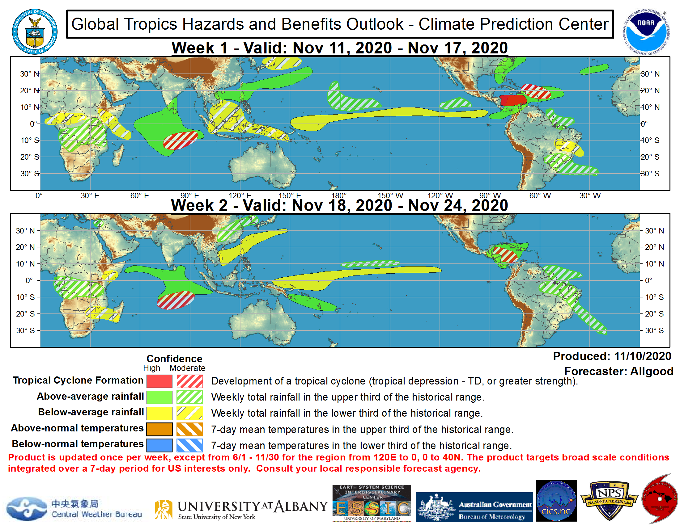
For Week 1, it predicted that Luzon would have “above-average rainfall” and on Week 2, it predicted that its northern portion would have “below-average rainfall.”
Typhoon Ulysses, the recent to lash parts of Luzon, including Metro Manila, entered PAR on November 9 and made its first landfall in Patnanungan in Quezon Province. It exited PAR on the morning of November 13.
Meanwhile, PAGASA on Wednesday said that four more storms could hit the country before the end of the year. It didn’t note that it would immediately enter PAR after “Ulysses.”
These would be named “Vicky,” “Warren,” “Yoyong” and “Zosimo” once they enter PAR.
The Philippines is visited by an average of 20 tropical cyclones every year, in which five of it is considered “destructive.”
It is located within the typhoon belt of the Pacific and the “Ring of Fire” which makes it exposed to various natural disasters such as typhoons, flooding, landslides, earthquakes and volcanic eruptions.


