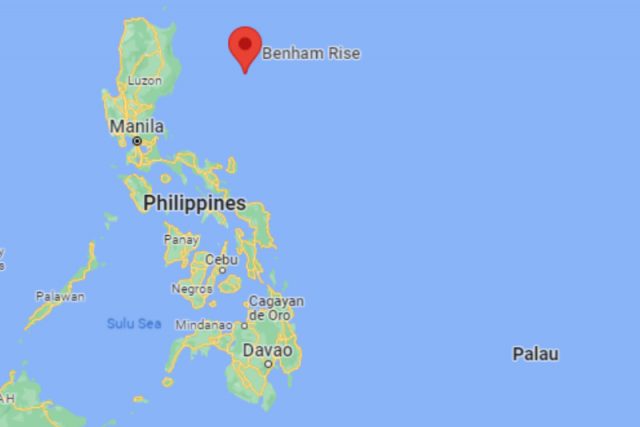
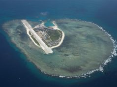
Benham Rise, a disputed undersea region, has been part of the Philippines’ formation for over 13 million years.
Disaster scientist Mahar Lagmay released a video clip about the country’s history on Twitter on September 22.
“History of the Philippines from 35 million years ago,” Lagmay tweeted with hashtags #BenhamRise #UNCLOS and #ECS.
History of the Philippines from 35 million years ago. #BenhamRise #UNCLOS #ECS pic.twitter.com/2onEurv4a2
— Mahar Lagmay (@nababaha) September 21, 2022
The video showed that a land mass, which will soon be called “Luzon,” and Benham Rise started existing at the same time.
As time progressed, the plateau moved closer to the land mass until the entire archipelago was formed.
The archipelagic province of Palawan was also shown to attach itself to the area to form what will soon be known the Philippine territory.
Under the replies, Lagmay shared a link to an old study he co-authored about the Philippine tectonic plate that he used as a reference for the video.
The article titled “New Definition of Philippine Plate Boundaries and Implications to the Philippine Mobile Belt” was published in December 2009 via Research Gate, a Europe-based social networking site for researchers and scientists. It can be downloaded on this link: ResearchGate.
Benham Rise and the Philippines
In the article, it was stated that a major collision event between Luzon and Benham Rise became pivotal to the evolution of the Philippines.
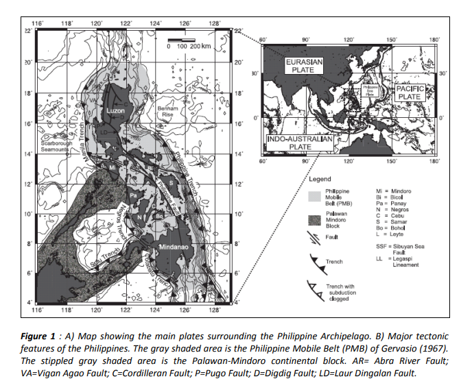
“A major collision event between the eastern border of Luzon and the Benham Rise, a large oceanic plateau, (Figure 1) occurred during the Early Miocene (Bautista et al., 2001; Lallemand et al., 1998; Sajona et al., 1997),” the document reads.
“The collision is a major episode in the evolution of the Philippines well-preserved in the stratigraphic (Karig, 1973; Lewis and Hayes, 1983; Florendo, 1994; Bautista et al., 2001) and structural records (Pinet and Stephan, 1990; Ringenbach et al., 1993), which is supported by new Gravity and GPS (Rangin et al., 1999; Galgana et al., 2007) data,” it added.
Figure 1 in the report showed the following:
- Map showing the main plates surrounding the Philippine Archipelago
- Major tectonic features of the Philippines
This undersea region stretches from the coasts of Cagayan to the Bicol Region.
It was only given a name after an American admiral geologist named Andrew Benham discovered it in 1993. It was later named after Benham.
Exploration of marine life followed after the undersea was found.
Scientists and researchers from the University of the Philippines Marine Science Institute have been conducting these explorations for the place’s conservation for years.
RELATED: Looking out for Benham Rise and giant clams: What UP MSI does besides giving free advice
On being part of Philippine territory
In April 2012, Benham Rise was declared part of the Philippines’ extended continental shelf following the approval of the United Nations Commission on the Limits of the Continental Shelf (CLCS) of the country’s claim on it.
RELATED: From bold promise to ‘publicity stunt’: The evolution of Duterte’s jet ski pledge
In 2017, former President Rodrigo Duterte renamed the oceanic province “Philippine Rise” by virtue of Executive Order 25.
Under the EO, the National Mapping and Resource Information Authority (NAMRIA) shall then produce maps and charts that will use Philippine Rise in lieu of Benham Rise.
Despite these laws in place, China and other countries still had staked their claims over the plateau.
China named five of its features, namely, Haidongqing Seamount, Jinghao Seamount, Tianbao Seamount, Jujiu Seamounts and Cuiqiao Hill.

