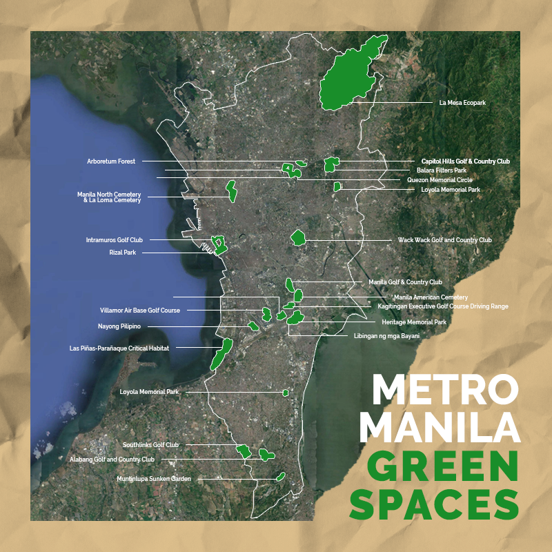
A Facebook user’s map of green spaces in Metro Manila showed that the remaining areas with greenery are grass parks in golf and country clubs and cemeteries.
User BA Racoma indicated that his sources were the Philippine Statistics Authority and the National Mapping and Resource Information Authority for the boundaries and the Open Street Map for the roads, water and green spaces.
He posted this on September 9 and soon made rounds more than 5,000 times on Facebook. It also became a trending topic on Reddit.
“Quite a number of people were asking for a Green Spaces of Metro Manila map. I knew what to expect but I didn’t realize it would make me this sad,” Racoma said in the caption.

He specified that any forest, grass, nature reserve, park or meadow was considered as “green space” based on Open Street Map.
However, the results that came out on the free online map may have left out some data and included grass-filled places.
“I included GRASS in the Green spaces so the following are included: golf and country clubs (Wack-Wack, Southlinks, Ayala), cemeteries (The Heritage Park, Himlayang Pilipino, Eternal Gardens Memorial Park, Ever Memorial Garden), and yes, NAIA,” he said in the disclaimer.
Moreover, he noted that some large parks such as the Quezon City Circle and the greenery at the University of the Philippines-Diliman were just dots on the map given the scale of the region.
“If you do not see your local green space, please consider contributing to OpenStreetMap adding he proper land use tags in the mapped regions,” he said.
In the photo, the largest green space was the La Mesa Eco Park in Quezon City. The rest were scattered patches throughout Manila.
A Reddit user cited another endangered urban sanctuary in the south of Manila—the Las Piñas Parañaque Critical Habitat and Ecotourism Area.
This 175-hectare wetland is home to a mangrove forest declared critical by the environment agency.
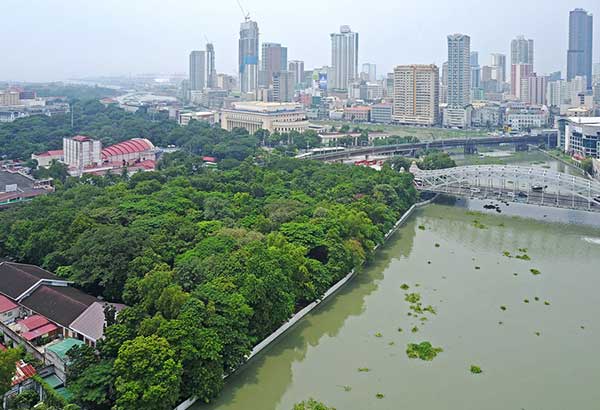
Last July, the Arroceros Park in Manila or the city’s so-called last lung was saved from developers and even included in Manila Mayor Isko Moreno’s ambitious plans of turning Manila into a green city.
Only 12% of green space remains in the metropolis, according to data from the Department of Environment and Natural Resources.
Meanwhile, the city of Manila has the least green spaces among the 16 cities with only 140.4 of 3,800 hectares in total land area.
Why do green spaces matter?
The rising temperatures of urban heat islands such as Metro Manila are what expanding green spaces sought to reduce.
The National Geographic defines an urban heat island as “a metropolitan area that’s a lot warmer than the rural areas surrounding it.”
Urban heat islands or UHI normally comprise residential houses, commercial establishments and other industrial buildings with people moving their daily activities at a small space.
Green spaces such as nature reserves, wetlands and forested parks reduce the harmful effects in UHIs and even contribute to the overall mental health of the residents.
The World Health Organization strongly suggests building more green spaces to cool the city, provide safe transportation and promote physical and social activities among people.
“Green spaces also are important to mental health. Having access to green spaces can reduce health inequalities, improve well-being, and aid in the treatment of mental illness. Some analysis suggests that physical activity in a natural environment can help remedy mild depression and reduce physiological stress indicators,” the organization said.
In the Philippines, the Department of Science and Technology launched a project called Project GUHeat or “Geospatial Assessment and Modeling of Urban Heat Islands in Philippine Cities” this 2019 to help local governments minimize the harmful effects of UHIs.
This project will also help the LGUs incorporate correct measures or policies to make their localities safe, resilient and sustainable, which is Goal 11 of the United Nations Sustainable Development Goals.


