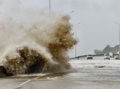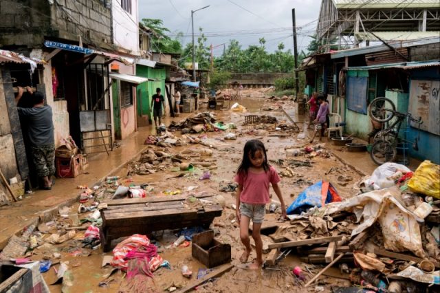
- Typhoon Gaemi floods killed 48 in Philippines
- Crowd-sourced data could improve flood models
- Citizen science could hold key to disaster mitigation
MANILA (Thomson Reuters Foundation) — Crowd-sourced data could help better predict the effects of the tropical storms and typhoons that regularly batter the Philippines and so save lives, disaster risk experts said.
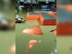
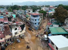
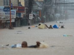
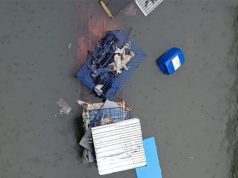
When Typhoon Gaemi hit the country in late July, Mahar Lagmay, head of the Nationwide Operational Assessment of Hazards (NOAH), requested people submit photos of flooding in their area to contribute to the project’s flood hazard models.
He said the reports would help test the accuracy of current models and correlate the amount of rain to the actual level of flooding and so help predict future flood hazards.
The Philippines is hit by around 20 large storms every year and, due to climate change, that is expected to only get worse.
“Typhoons will become more frequent and stronger, bringing in more rains. When that happens, the floods will become bigger as well and become more frequent,” said Lagmay.
Typhoon Gaemi killed 48 people in the Philippines and nearly 100 elsewhere in the region.
When the Taal Volcano, about 70 km (45 miles) south of central Manila, erupted in 2020 killing 39 people, NOAH, the country’s primary disaster risk reduction and management program, asked people to report how thick the ash was in their neighborhood.
“A lot of people submitted. And because of those submissions, we were able to recreate the deposit footprint of the ash fall for the eruption,” said Lagmay.
NOAH then calculated the volume, height, intensity and discharge rate from the volcano and used the data to predict the effect of future eruptions.
“When you have citizen engagement, it raises their stake at solving the problem. Because there’s ownership. They’re part of the solution to the problem,” said Lagmay.
The Taal Volcano erupted again on Wednesday, but officials said the alert level was low and there were no reports of injuries.
Citizen engagement more cost effective
The dangers of floods and other natural disasters are very real for people like Allan Figueroa who works driving a jeepney passenger vehicle.
Typhoon Gaemi left his Manila neighborhood chest-deep with water, but despite official warnings the day before of heavy rain and strong winds, Figueroa said he and many others were caught out.
“We thought, based on the forecasts, that flooding might come not until noon the next day,” he said.
But before he and his family could evacuate, it was too late. The jeepney he relies on for a living was washed away, he said, and he and his family took shelter on the top floor of a neighbor’s house until the water subsided.
The issue for countries like the Philippines is that building flood hazard maps is costly and resource-intensive. The United Nations says this type of mapping is mostly carried out by developed countries.
So citizen engagement could be more cost effective in poorer countries.
Narod Eco of the Advocates of Science and Technology for the People, a non-governmental science advocacy organization based in the Philippines, said scientists could merge scientific and community or indigenous knowledge to deal with disasters.
But whether it be data mining, crowdsourcing, or conducting scientific activities in communities, Eco said scientists must be careful not to exploit people for the sake of science.
“We need community engagement that recognizes people’s immediate needs and builds trust,” said Eco, an expert in disasters and community science, “For example, we can present the findings of our study to communities or give them access to the data.”
Investing in knowledge
Helping communities has been one of the core aims of NOAH since it was founded by the government in 2012 in the wake of Typhoon Sendong, which claimed 1,000 lives in the Philippines.
It issues pre-disaster risk assessments that enable the public to access hazard-specific, area-focused and time-bound warnings.
In its first five years, NOAH completed flood hazard mapping for 70% of the Philippines’ total area. But President Rodrigo Duterte cut funding in 2017 and NOAH was taken over by the University of the Philippines, though with fewer resources.
Lagmay said the project needs more funding to build future and larger hazard models, including of mountainous terrain that is now being flooded.
Despite these issues, NOAH is trying to expand its reach by partnering with local government to craft disaster management plans.
“Those who seek help, we try to help,” said Lagmay.
Current President Ferdinand Marcos said in July that his government had completed 5,500 flood control projects worth 245 billion Philippine pesos ($4.36 billion).
But Lagmay said flood controls, such as building dikes, could only go so far. Rapid population growth in Manila, coupled with the effects of climate change, made it hard to manage bigger floods and other disasters, he said.
“I think it’s high time that we consider decongesting the metropolis because it’s very hard to do disaster risk reduction if the community is overcrowded and overpopulated,” Lagmay said.
He said there was a need to collaborate with universities, local government and the public.
“We need to invest in the science. We need to invest in the people who do the science. Because that’s the only way … you can make people trust your pronouncements,” said Lagmay.
“I’m not saying that every time it’s going to be 100% accurate, but you’re increasing the percentage of the accuracy,” he said.
($1 = 56.1500 Philippine pesos)
—Reporting by Mariejo Ramos; Editing by Jon Hemming


