Experts from the University of the Philippines asked the public for help in reporting sightings of the oil spill in Oriental Mindoro.
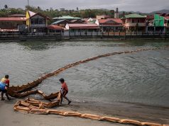
A massive oil spill near the province continues to wreak havoc on the health and livelihood of thousands of fishing communities there since the oil tanker incident last week.
READ: Oriental Mindoro oil spill leaves fishers short on cash and food | DOH to residents near oil spill: Drink water from safe sources, wear industrial mask
The deadly liquid came from the tanker MT Princess Empress, which was carrying 800,000 liters of industrial oil. It capsized off the coast of Oriental Mindoro on February 28.
Reports said that authorities have yet to determine the full extent of the disaster.
In its bulletin on March 8, the UP Marine Science Institute (UPMSI) asked the public for help, particularly residents near the affected areas, to report any oil spill sightings.
UPMSI is currently monitoring the damage through a volunteer-based initiative called Karagatan Patrol.
Through its social media accounts, the institute attached the link to a form where people can officially report photos and videos of the aftermath.
“Help us improve the forecasts by reporting sightings of the oil spill,” the institute said.
Those who wished to report their observations can submit them here NAUJAN, ORIENTAL MINDORO OIL SPILL (google.com).
Karagatan Patrol’s interactive map can be accessed here Karagatan Patrol VIIRS-Boat Detection.
The post was also accompanied by photos of what has been mapped out so far.
The right photo showed that the industrial oil has reached Caluya Island in Antique in the Western Visayas region, as of March 8. Therefore, the liquid has already traveled beyond the waters of Oriental Mindoro and the Mimaropa region.
“Karagatan Patrol mapped the [oil spill-affected] municipalities and barangays based on verified reports of oil slick sightings and onshore deposition in their website (http://karagatanpatrol.org). Patterns of oil sighting strongly coincide with the oil spill trajectory model of the UP MSI. This information helps refine the model to better forecast movements and trajectories,” UPMSI said.
The institute also issued a disclaimer that while models are developed to inform the public, they still bear “some levels of uncertainty” due to how the data was collated.
“Models are generated to inform the public on the potential direction of transport of the oil spill and help direct response efforts on the ground. However, models have some levels of uncertainty due to assumptions and limitations, and thus, should be used with caution,” UPMSI said.
How much damage so far
In a post on March 4, UPMSI stated that the oil spill could have affected over 36,000 hectares of coral reefs, mangroves and seagrass that thrive in the waters that are off the coast of Oriental and Occidental Mindoro, Palawan and Antique.
RELATED: Oil spill hits tourism in Oriental Mindoro
Experts from the institute further noted that more than half of the potentially affected biodiversity is found in the Cuyo group of islands.
The Philippine Space Agency (PhilSa), meanwhile, released photos from satellite imageries that showed how far the oil has traveled since the tanker sank last week.
All the images can be accessed here Oil spill in Philippines – Activations – International Disasters Charter.
PhilSa noted that the base maps it used are from Wikimedia Maps.
Satellite data, meanwhile, was retrieved from the International Charter Space and Major Disasters (Disasters Charter).
The Disasters Charter is a collaboration of space agencies and space-related institutions in the world that aims for more accessibility of satellite data for disaster management.


