Iconic shape!
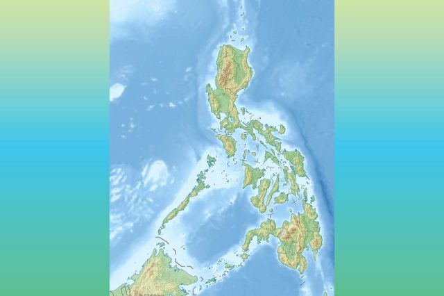
For some Pinoys online, the Philippines’ unique shape and intricate edges are another subject for pride and admiration.
The archipelago is composed of three major islands known as Luzon, Visayas and Mindanao with Luzon as the largest island, followed by Mindanao and the Visayas
On X (formerly Twitter), some online users could not help but boast about its cartography compared to other countries.
philippines has the most intricate shape for a country idc what anyone says https://t.co/reJtNaaPxk
— lai 🇵🇸 (@alaysaito) August 24, 2024
The Philippine islands are often compared to a giant sleeping on the ocean floor, a cow, a dog, and sometimes a woman.
Its pretty like a woman 🌺
— ghost | artist (@_nagmumulto) August 25, 2024
“We’re romanticizing country shapes and I’m all for it,” a Pinoy X user commented.
“I remember all those times when they made us draw it during elementary school,” another online user shared.
“I always think it’s a flex that we have the most unique shape out there lol (until you look at the contemporary issues arising from living in an archipelago),” a different Filipino online wrote.
Unbeknown to many, the Philippines is not only shaped by the shifting of tectonic plates.
“There’s nationalist pride of course. But at the same time, American colonization heavily shaped Philippine provincial borders,” mapmaker and independent research David Garcia said.
Garcia also said this spectacle online could be called “viral cartography”.
This concept of viral maps specifically explores the characteristics of maps that go viral online.
A study on this has been utilized to inform mapmaking practices and affordances.
While the conversation online comparing maps is light and harmless, Garcia reminded that there is more to this than meets the eye.
“Generalizations on what is geographically ‘complex’ and ‘simple’ can really vary based on perspective,” he told Interaksyon.
“It cannot be reduced to visual appearance,” he added.


