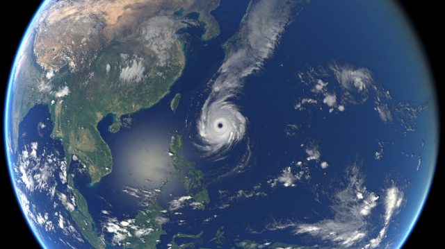
Typhoon Ompong (Mangkhut) left billions of damaged properties and many casualties at its wake. As soon as it left, Typhoon Paeng (Trami), another powerful cyclone, just entered the Philippine Area of Responsibility.
Both have been categorized as super typhoons by the Hawaii-based Joint Typhoon Warning Center of the United States Navy.
The Philippines’ vicinity is visited by more than a dozen cyclones every year. But why do these seem to be getting stronger? Some experts are looking into an underrated phenomenon—climate change.
Climate change and typhoons, how are they related?
Aside from the storms Florence and Mangkhut earlier this month, it was reported that four other storms were around the same time formed in other parts of the world—Helen, Isaac and Joyce in the Atlantic, while Olivia was brewing in Hawaii.
How climate change might have a hand in this phenomenon could be traced to how a tropical cyclone is formed from the beginning, a report explained.
Climate change is not new because the planet’s climate had been constantly changing.
However, the rapid rise of temperatures of the earth’s surface caused by harmful greenhouse gases emitted by human activities also affect climate to change more quickly than it naturally would.

Increased temperature of sea surfaces is seen as the cause of these intensified storms, according to Xie Shang-ping, an environmental scientist.
“Warm sea surface temperatures help intensify tropical cyclones,” he shared.
A tropical cyclone, a type of storm, can be likened to a “giant engine” fueled by warm, humid air from the oceans near the equator, hence the name.
As surfaces of oceans get warmer due to global warming, the amount of humid air from the waters sends more fuel to the engines of the cyclone, thus making it stronger.
Moreover, the cooling of the northern hemisphere in late summer also helps in making the warm oceans to evaporate, condense and develop into cyclones.
So far, there were four tropical cyclones that intensified into super typhoons, this year, namely, Mangkhut, Jelawat, Maria, Jebi and Trami.
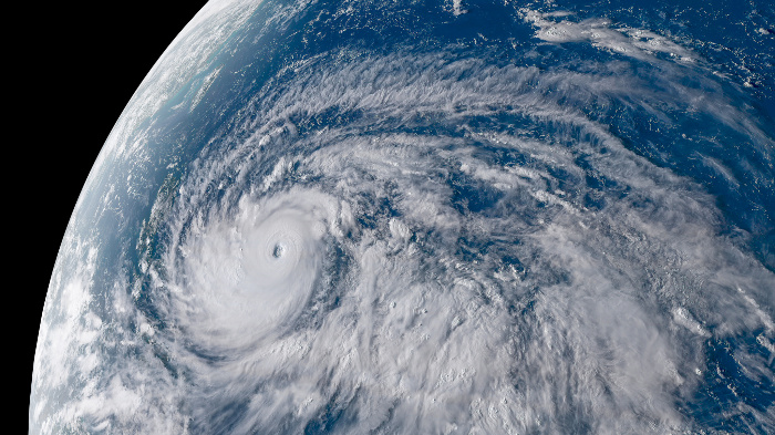
Super #TyphoonTrami (#Paeng) has sustained winds of 149 MPH (240 KPH) with gusts to 184 MPH (296 KPH). The JTWC expects a slow drift to the NW, impacting #Taiwan and the southern islands of #Japan later this week. (JMA Himawari imagery) pic.twitter.com/0P5leRmVTo
— NASA SPoRT (@NASA_SPoRT) September 24, 2018
The super typhoon intensity is normally attributed to the strongest of storms or those with maximum sustained surface winds of at least 65 miles per hour.
According to the Hong Kong Observatory, there are more super typhoons in recent years as compared to the period from 1961 to 2010.
In 2013, the Philippines fell victim to Typhoon Yolanda (international name: Haiyan) that was considered one of history’s most powerful storms.
Its record winds and resulting storm surges nearly flattened small towns and villages in Leyte off the map and caused millions of casualties in the Eastern, Central, Western Visayas, Mimaropa, Bicol, Caraga, Northern Mindanao, Calabarzon and Davao regions.


