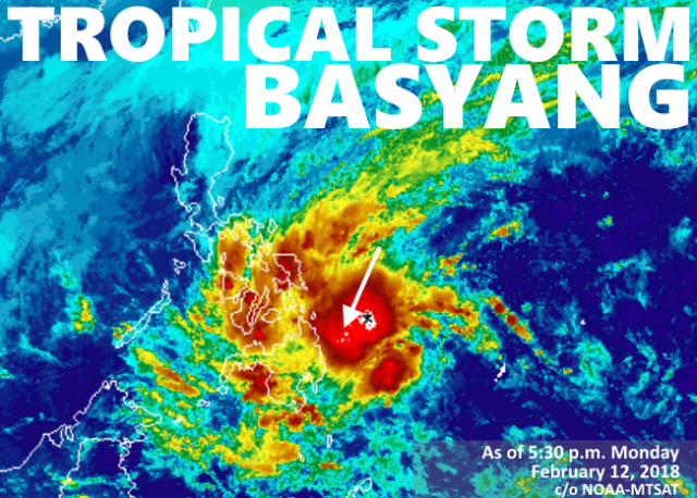
The state weather bureau Philippine Atmospheric, Geophysical and Astronomical Services Administration, or PAGASA, declared 27 areas under storm warning signals as of early Monday evening.

(Above) Storm tracking of #BasyangPH rendered in an animated loop. Please allow time for component images to download completely. The loop will auto-play, and is constantly updated with fresh data every 30 minutes.
Please feel free to bookmark and revisit –> the link to this image above from time to time over the next few days to follow the storm’s progress via the animation loop.
Tropical Cyclone Warning Signal #2 was hoisted over Surigao del Sur, Surigao del Norte, Agusan del Norte, Agusan del Sur.
Signal #1, on the other hand, is up over southern portion of Samar, southern portion of Eastern Samar, Leyte, Southern Leyte, Bohol, Cebu, Negros Oriental, Negros Occidental, Siquijor, Guimaras, and Iloilo in the Visayas, and, in Mindanao, Dinagat Islands, Camiguin, Compostela Valley, Davao Oriental, Davao del Norte, Misamis Oriental, Misamis Occidental, Lanao del Norte, Lanao del Sur, Bukidnon, northern portion of Zamboanga del Norte. and northern portion of Zamboanga del Sur.
The weather disturbance was observed to have accelerated slightly as it continued to approach the coast of Eastern Mindanao, bringing with it scattered to widespread moderate to heavy rains in the next 24 hours over Visayas, Caraga, Northern Mindanao, Zamboanga Peninsula and the provinces of Davao del Norte, Davao del Sur, Davao Oriental, Compostela Valley, North Cotabato, Maguindanao and Lanao del Sur.
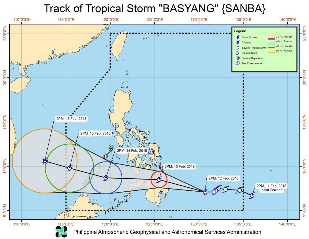
The storm is expected to make landfall in the Caraga Region sometime between morning and afternoon of Tuesday, February 13.
PAGASA also indicated the possibility of raising of TCWS Signal #1 over Aklan, Capiz, Antique, Zamboanga Sibugay and the rest of Zamboanga del Norte and of Zamboanga del Sur toward midnight Monday.
At late afternoon Monday, the center of the storm was plotted at approximately 435 kilometers east-southeast of Hinatuan, Surigao del Sur (coordinates 07.3 °N, 130.1 °E), packing top winds of 65 kilometers per hour near the center and gusts of up to 80 kph, forecast to move west-northwest at 23 kph.

